Dubai World - Palm Jumeirah Islands Aerial - Google Earth


Dubai World - Palm Jumeirah Islands Aerial - Google Earth
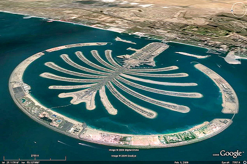
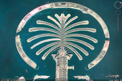
Dubai Palm Islands Aerial - Google Earth
Those are the amazing Dubai artificial "Palm Islands". Not sure it's good use of the earth resources needed to build them, but it looks cool.
The investment company that owns those has been in the news recently, because they are basically going bankrupt before completion of the project, causing turmoil in the financial world.
And also they are a little bit worried that it will be under water soon with Global Warming.
For more information about the Dubai Palm Istands, go to www.2daydubai.com/pages/dubai-palm-jumeriah.php , en.wikipedia.org/wiki/Palm_Islands and en.wikipedia.org/wiki/Palm_Jumeirah
This photo is © Google Earth, used by permission (this overwrites any other copyright mention that may appear on this page)