Mobile Mapping Car


Mobile Mapping Car
360 degree camera
3d sensors
big brother
car
digital mapping
GNSS
hardware
IP-S2
LADAR
lidar
microsoft bing
mobile data collection vehicle
mobile mapping
navteq
remote sensors
scanners
street view
topcon
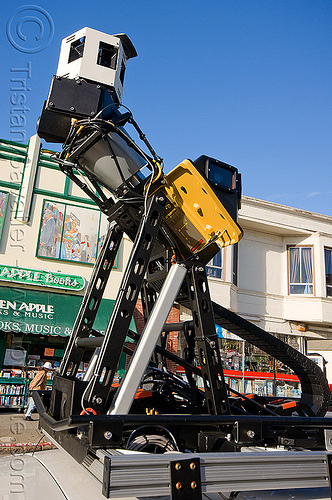
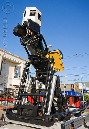
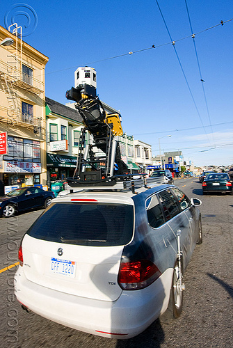
The other day i stumbled upon a car driving around the city with a huge sensor apparatus on its roof.
The sensor hardware included LiDAR laser remote sensors, 360 cameras, a very accurate satellite positionning system, and a bunch of other hi-tech gadgets. The system was active and capturing huge amount of data. This a real, and Big Brother is watching you.
The car belongs to a digital mapping company called Navteq, and the Sensors System is made by a company called Topcon Positionning Systems.
It appears that Navteq is doing the mapping and street view photography for the Microsoft Bing search engine.
Photo taken on
March 1, 2011
[location not available]
[an error occurred while processing this directive]
Selected album: